|
Using Bike Trails
Google maps shows there are thousands of kilometres of bike trails around Melbourne. As I ride
many of the bike trails around Melbourne (and beyond), Bike Trail enables me to share the bike trail
route and provide a link so you can watch a video of the bike trail ride.
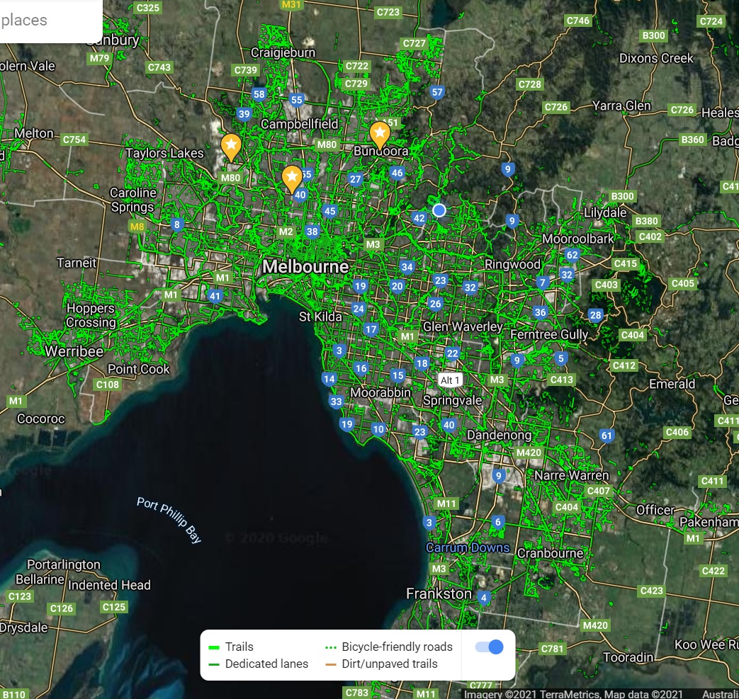
Credit - Google Maps
When Bike Trail starts the latest bike trail is shown on the map. Select a bike trail from
the drop-down list to show the route for a bike trail. The bike trail is centred on the map
After selecting a bike trail a link to the bike trail video will appear
below the map if a video is available. If a 360 video is available for the bike trail a second link will appear. Click
on the link to watch the video in YouTube.
The red line is the bike trail route
which is displayed when you select a bike trail using the select drop-down list above.
-
Use the zoom in and zoom out buttons to zoom in or out of the map. You can also zoom in and out using a pinching
motion on your touch screen.
-
Reposition the map by dragging the map with your mouse or finger.
-
Click/press on the bike trail route and the video start time will change to near where you've pressed.
-
If you've been watching the video of a bike trail and would like to check the location, note the time on the video and then
click on the bike trail route until the video start time is near the time in the video.
-
Click on the route to show the estimated distance from the start of the ride. You can click anywhere near the bike trail
and the point on the bike trail closest to where you click. Click before the trail will show you 0km and clicking after the end
of the bike trail will show you roughly the distance covered.
NOTES:
-
The timing of videos isn't always accurate. Sometimes sections of videos have been removed due to poor GPS readings
or for some other reason. Older videos weren't timed to the second (routes are not smooth), or were manually created and clicking
on the video will not give a meaningful start time.
-
YouTube often starts videos on a lower quality a then adjusts. To get around this perhaps start the video
around a minute before the section you're interested in. Rewind if necessary.
-
The region covered by the map varies at each zoom level. The area covered is Melbourne.
-
When using the zoom buttons or + and -, once you reach the zoom limit the buttons are greyed out. For bike trails covering
small areas the zoom may start at the maximum level. For bike trails covering larger areas there are usually one or two additional
zoom levels to zoom into the map and 6 to 7 zoom levels to zoom out of the map.
-
When zooming, if the map goes grey, this is by design. Only the areas where bike rides have been completed can zoom to the lowest
level. This is a compromise to hopefully enable people to zoom on the bike rides to sufficient detail without the need to download
map tiles that aren't necessary for this application. If the map goes grey but the red trail still shows zoom out until the map appears.
|